Why do you need GPS?
There are many different uses for GPS on a mobile phone. Most often, this is navigation, when you need to see where you are and how to get to the right place. But there are dozens of other uses. For example, when you want to publish a tag with a geotag, if you order a taxi or goods tied to a region - and so on. Even some games (like Pokemon GO) use GPS.
Basic functions of a GPS navigator
The amount of additional functionality on devices differs. There are navigators with voice control. But most of them perform several functions:
- determining the position on the map using data from satellite systems;
- constructing a route if the coordinates of the starting and ending points or its name are known;
- accurate navigation along the route - at each stage the system displays the direction of movement, determines the remaining distance, and calculates the time of arrival;
- automatic or manual recording of the route traveled, which is stored in memory.
How to enable GPS on Android
The activation procedure on different versions of Android OS is approximately the same.
Method 1
- Open the Quick Settings panel, where all the main Android options and settings are located.
- Click on the “Location” or “Location Data” icon. The name varies depending on the mobile OS version.
Method 2
Wait for the application to ask you for geolocation and allow appropriate access.
Method 3
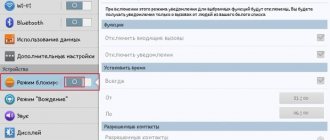
- Go to “Settings - Biometrics and Security - Location”
- Enable user location data by moving the Off slider to the right.
How to install a navigation app
The navigation application is a full-fledged alternative to a separate device - a navigator. To run the program, you first need to download it. It is best to choose an application from the official Play Market store. Here you can read reviews and choose the most suitable option.
A useful option for navigators is the ability to plot routes and estimate the time to cover them based on built-in calculations. There is a wide variety of applications. Let's take a closer look at some of the options.
How to Calibrate GPS: Best Methods
If the GPS module on your phone is broken, it needs to be changed, but if it shows not entirely correct data on the map and deviates from the norm in every possible way, there is a chance to solve the problem using software. There are two popular programs that can help you calibrate (i.e. improve accuracy) your GPS. Both can be found on Google Play Market.
GPS Status & Toolbox
The easiest way to calibrate is to use the GPS Status & Toolbox program. Among other features, it allows you to reset your phone’s connection with satellites and adjust GPS accuracy virtually from scratch.
GPS calibration is performed as follows:
- Open the side menu (to do this you will need to swipe from left to right),
- Select Manage A-GPS States.
- Click "Reset" then "Download".
- Calibration will begin, after which geolocation services will successfully return to full operation.
Helpful information. Read more about calibrating and setting GPS parameters here.
GPS Toolbox
Another app that allows you to calibrate your GPS without any fuss is GPS Toolbox. In general, this is a very multifunctional program that has many different functions and settings related to geolocation.
Calibration in GPS Toolbox is done as follows:
- Click on the Compass icon. A virtual compass will open. If it shows everything perfectly correctly, the problem is somewhere else, but if it is not accurate, it can be calibrated.
- Select Calibrate. In some versions of the application it may not be available, so you just need to rotate the phone from side to side, turn it over until the readings become more or less accurate.
GPS calibration in the normal way
Finally, a slightly more complex option for setting up GPS is to use the built-in functions of your phone. To do this you need:
- Go to the engineering menu by dialing *#*#3646633*#*#, less often the combinations *#*#4636#*#* or *#15963#* work;
- A special hidden menu will open. In it, select EPO, check Auto Download and Enable EPO;
- Go back and select YGPS - Satellites;
- A diagram with satellites will appear, where unconnected satellites will be indicated in color;
- Go to the Information tab, select Full and AGPS Restart
- Return to satellite map
- After some time, the calibration will be completed and they will turn green again.
Why do you need a geolocation system on a smartphone?
Interaction with the GPS module has long been no longer limited to just the ability to view your location. Programmers from various services have learned to interact with the received navigation data and use it in their products. Let's look at the main applications that use location data and, most importantly, why they do it:
- Google services use information to track the places a person visits. A special chronology is created, divided into days, which can be viewed or disabled in your personal profile. At the same time, for convenience, actively visited addresses are marked with tags: home, work, etc.
- Search for a lost device - if lost, data from the smartphone is sent to the company’s server, showing the current location of the device. You can read more about what to do with a missing phone in the material: How to block a phone?
- Maps and navigators are an obvious example; mapping services help you get directions to a given point and find out about the location of interesting places nearby.
- Shops and trading platforms offer current offers, in accordance with the region of residence. For example, Yandex Market automatically switches the area and shows stores where the product is available according to the city.
- Social networks and dating apps constantly collect information to show people with whom the user may be familiar. Advertising offers and posts in the “Recommendations” section are 80% collected based on location and mutual friends.
We recommend: Auto-dial feature on your smartphone
There are also a huge number of local examples where information from GPS on a smartphone is used. Therefore, it is difficult to deny the importance of enabled geolocation when working with programs and in everyday life.
How to enable GPS location on Android?
Let's look at how to find and configure the location function on Android
. Go to system parameters. This can be done by clicking on the gear icon in the notification panel or, using the separate Settings application.
In the list, select the “Security and Location” section. Go down to the “Privacy” section and click on “Location”.
This window is responsible for setting up and tracking all geographic data used. To enable GPS functions, move the slider at the top. Unlike specialized devices, there will be no questions here: “How to set up a navigator in a tablet or phone on Android”
. Just turn on Yandex or Google maps and get directions.
Important: To speed up the connection to navigation satellites, you will need to enable a parameter that increases the accuracy of the work. Select “Location determination” and give permission for a more precise determination. Now mobile Internet and Wi-Fi networks will be used for acceleration.
What to do if GPS doesn't work
Let's consider all possible reasons for GPS failure:
- The GPS module is broken . All that remains is to take the phone for repair. If the theory is confirmed, it will not be possible to solve the problem programmatically.
- The phone's memory is full and is not enough to activate communication with satellites. In this case, you need to clear the memory and restart the phone.
- Presence of malware . In this case, you should check your mobile device with an antivirus and reboot it.
- Incorrect firmware . This is a possible reason if you have modified your phone with unofficial firmware. Try performing a hard reset.
- Weak satellite signal. Although most of the Earth is covered by a network of GPS satellites, sometimes, especially far from civilization, the GPS signal is extremely weak. In this case, you need to move to another place.
How to use a navigator in a car
You need to find a place to install the device. Typically, a mount is used for this, which fixes the device on the windshield. The main condition must be met: it should not interfere while driving.
Follow the instructions for correct installation of the equipment:
- The place where it will be installed must be cleaned of dust and dirt.
- Adjust the tilt angle correctly to ensure you can clearly see the information displayed on the screen.
- There should be no loose wires, otherwise they may get caught.
Do not install the navigation device on the location of the airbag!
How to disable (partially and completely) GPS on Android
If for some reason you don’t want your phone to determine your location, or if you just want to save your battery as much as possible, you can turn off GPS.
How to disable GPS satellite connection:
- Open the quick settings panel, where you enabled this option,
- Find the “Location Data” button (depending on the OS version it may be called Location, “Location” or “GPS”) and click on it.
- The icon will change color from green to gray: the function is disabled.
If you want to save battery and still enjoy GPS functionality,
- Go to “Settings” - “Location” - “Power Saving Mode”.
- GPS will turn off, but the phone will determine its position using mobile communication stations and Wi-Fi access points.
Programs for GPS navigation and their brief characteristics
- Google Maps is one of the most popular apps on your phone. Works quite well on line and has the ability to display Google orthomosaics.
- Yanosik - works on the Internet, the service is a little complicated, but the user has access to current information about traffic jams, accidents and radars.
- MapaMap - works offline (without the Internet), but the most useful feature is only available with a subscription.
- Navatar works online and has many useful features.
- OviMpas - work via the Internet. Available for Nokia phone users.
- Route 66 - works offline (without the Internet), and the online version is available after purchase.
- Vito Navigator - works offline (without the Internet), the basic version (free) is very modest.
- NaviExpert - works online, free trial version only.
- Skobbler - free version, offline only, limited selection of features.
That's all. Good luck.
How geolocation works in smartphones
Every smart phone has a number of features that can provide opportunities that other devices cannot. Constant improvement of the operating system and supporting equipment expands the functionality.
The procedure for determining the location is as follows:
Satellite No. 1 sends a signal (a) directed towards the Earth and determines the speed and time of receipt of the response by the subscriber (d):
Satellite No. 2 transmits radio wave (b) to point:
Satellite #3 emits its signal (c) in the same direction:
By analyzing the travel time of the signal to the recipient and taking into account the location of the satellites, you can determine where the receiving point is located. If you also connect stationary methods, the accuracy will be several meters.
Knowing the location of the auxiliary elements, you can calculate the position of the object above ground level.
To use a satellite signal, you do not need to be on a mobile operator’s network, as it is a completely different system.
On smartphones, the geolocation icon looks like an upside-down blob and can be found in the quick access panel or settings. When the service is enabled, a similar symbol will appear at the top of the screen.